
DJI Mavic 3 Multispectral


DJI Mavic 3 Multispectral
Deze prijs is exclusief BTW. Alle belastingen worden berekent bij het afrekenen.
Reliable shipping
About this product
See more, work smarter
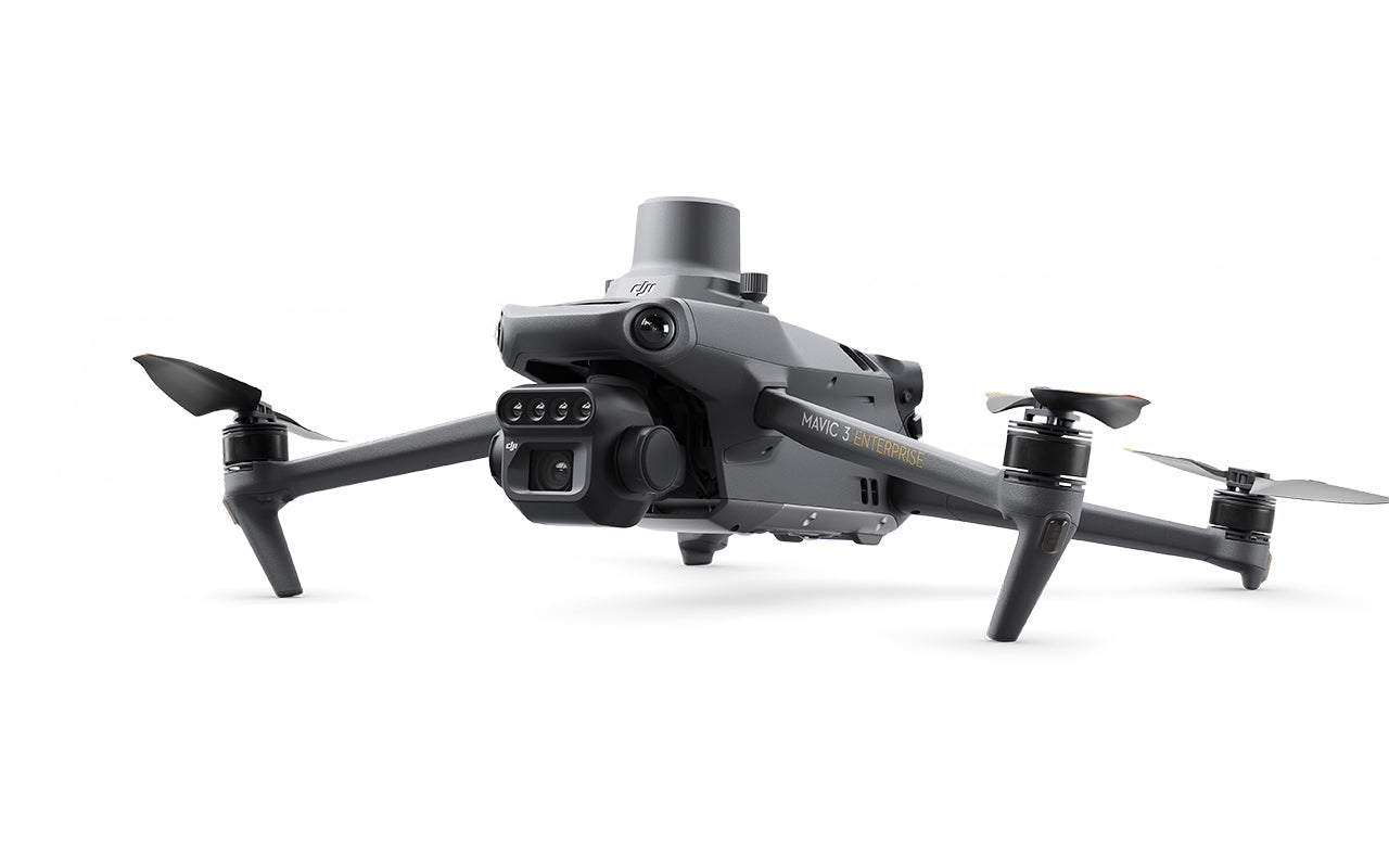
The DJI Mavic 3 Multispectral is a compact and powerful drone specifically designed for precision agriculture and environmental applications. This lightweight drone combines a high-quality 20 MP RGB camera (with a large 4/3 CMOS sensor and mechanical shutter) with four 5 MP multispectral cameras that capture the green, red, red-edge, and near-infrared spectrums. This provides in-depth insight into crop health and growth.
Thanks to the built-in sunlight sensor, solar radiation is measured and automatically corrected in the data, resulting in more reliable vegetation indices such as NDVI. The drone comes standard with an RTK module, allowing you to take centimeter-level measurements without the need for ground control points. The fast recording speed (0.7 s interval) and burst function enable efficient aerial mapping of large fields – up to 200 hectares per flight.
For safe and smooth flights, the Mavic 3M is equipped with omnidirectional obstacle detection (DJI APAS 5.0) and O3 Enterprise transmission, allowing you to maintain a stable connection up to 15 km (FCC) with live video transmission of 1080p at 30fps.
The drone works seamlessly with DJI Terra or the DJI SmartFarm platform, allowing you to create maps for applications such as variable rate crop protection or fertilizer application, perform automatic tree counts, and generate three-dimensional flight paths for agricultural drones like the DJI Agras series. Imagery can even be uploaded in real time via an optional 4G module, allowing for quick detection of anomalies in the field.
In addition to agricultural applications, the Mavic 3 Multispectral is also suitable for environmental and nature surveys, such as water monitoring, forest management, and urban green space analysis. Thanks to Cloud API support and DJI Mobile SDK 5, developers can easily integrate the drone with their own systems or apps for inspections, patrols, or data processing.
The DJI Mavic 3 Multispectral offers farmers, surveyors, and environmental professionals a powerful, accurate, and flexible platform for collecting crucial aerial data – all in a convenient and quickly deployable format.
This drone requires a C1 certificate of the pilot to be flown.
Specifications
In the box
Shipping
We will work quickly to ship your order as soon as possible. Once your order has shipped, you will receive an email with further information. Delivery times vary depending on your location.